NF Kaukonahua Stream Packrafting
Length: 2 miles?/ 1 day, shorter runs possible
Class: II
Gradient: 25 ft/mile
Recommended Flows: 35 to 100 cfs at NF Kaukonahua Stream above RB
Shuttle: none
Hike: 1.5 miles to put-in and .5 miles (300 ft elevation gain) back from take-out, Map of the trail
Season: Whenever it flows. More common after big winter storms
Overview
The North Fork Kaukonahua Stream is popular with tubers just after a rain storm. It is also fun to packraft but difficult to get on at higher than around 40 cfs unless it can be caught immediately after a peak event. Even if the stream isn’t high enough to run the Wahiawa Hills Trail is a fun hike with two stream crossings. It may look like there is easier access from the north side of the stream, unfortunately there is no way to get through the military base.
Current North Fork Kaukonahua Stream Flows
Ideal flows maybe 35, 50 better, 100 cfs best. More USGS Data for NF Kaukonahua.
Video: Packrafting Kaukonahua Stream Oahu
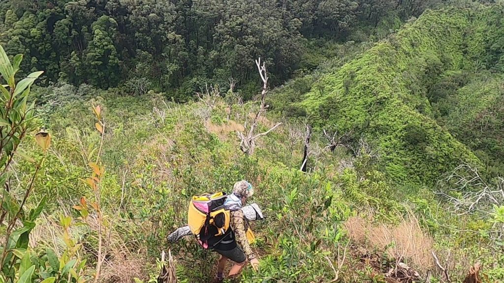
The Wahiawa Hills Trail
One of the highlights of this trip is the hiking the Wahiawa Hills Trail (also the trail head for the Schofield Waikane Trail). There are nice views before the steep descent into the canyon. The trail is well maintained loop hike that crosses the river twice. The descent to put-in can be tricky because it is typically muddy when there is enough water to run the stream. The hike back out is short and steep but not as slippery as the descent due to there being more roots and duff.
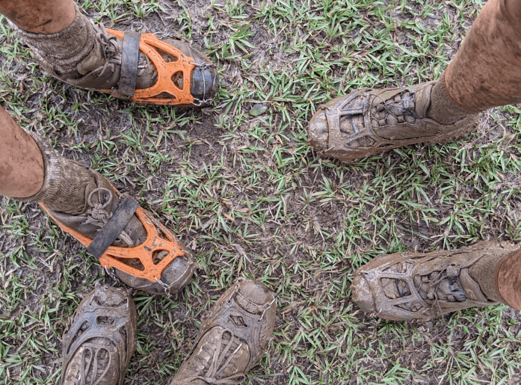
Microspikes
The trail down to Kaukonahua Stream can get muddy. Many hikers in Hawaii like using microspikes for added traction on muddy steep trails like this one. When carrying a pack full of gear they make descending more controlled and less dangerous. Microspikes cost a little over $20 and pack easily.
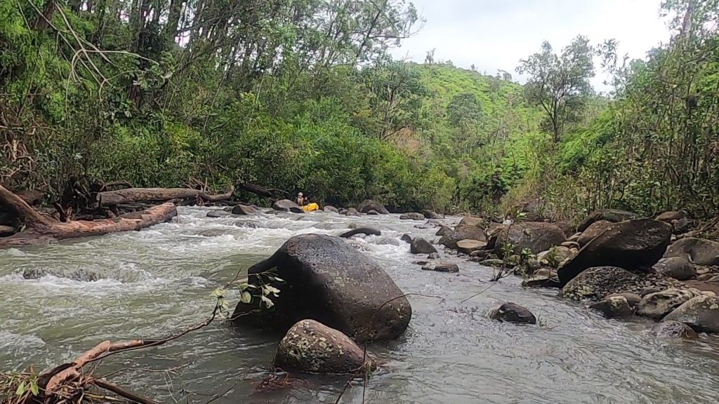
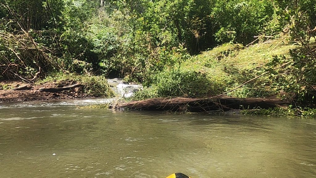
Running the Stream
The stream has rocky class two rapids throughout the run. The scenery gets better towards take-out as the canyon gets narrower. Wood is the major hazard and caused a few portages the day we ran. In general we felt lower flows are best to have time to stop above any strainers.
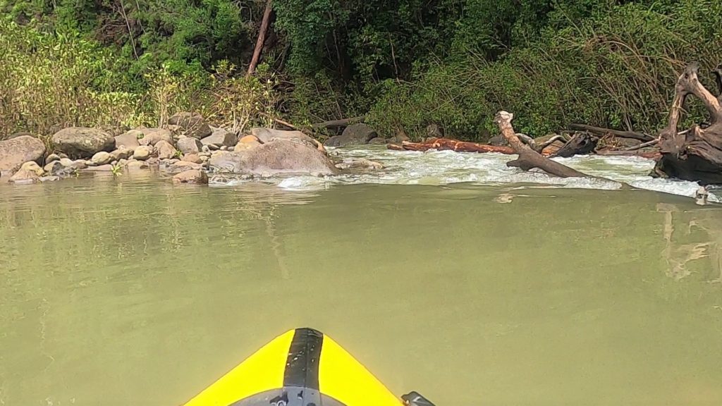
Not Missing Take-out
The key to this run is not missing take-out. There is a tributary coming in on river right around 15 minutes above take-out. It appears to be water diverted from the next drainage north. We are not sure if it is always flowing but it is a nice landmark.
It would be a good idea to walk down the 1/2 mile to take-out and take a look around before heading to put-in. Below take out the stream ends up in this reservoir that looks pretty filthy.
SF Kaukonahua Str near Wahiawa, Oahu, HI
When we paddled the North Fork the gauge was out so we used the South Fork gauge to get an idea of how much water was flowing.